Population Total 1214376; male 627200, female 587176; Muslim 924254, Hindu 278703, Buddhist 7156, Christian 131 and others 4132. Indigenous communities such as santal, oraon, munda, Mushar and rajbangshi belong to this upazila.
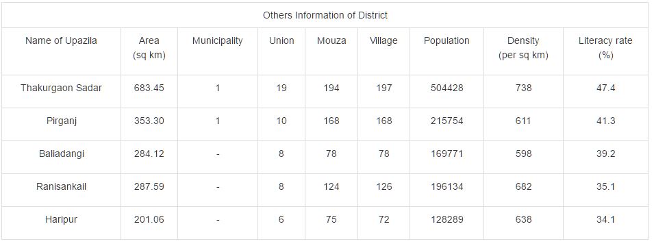
Administration Thakurgaon Sub-division was established in 1860 under the district of Dinajpur and was turned into a district in 1984. Of the five upazilas of the district thakurgaon sadar was the largest (683.45 sq km) and haripur is the smallest (201.06 sq km).

No comments:
Post a Comment